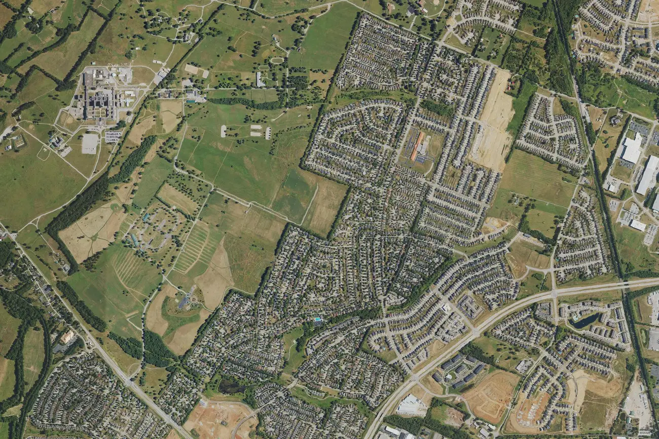
Masterson Station, in northwest Lexington, is in ZIP code 40511 and zoned for Bryan Station High. Its ZIP home value was $313,248 in September 2026.
Last checked Oct. 16, 2026. Sources: the Lexington-Fayette Urban County Government’s neighborhood association registry and open data (parks and address points), Fayette County Public Schools’ current attendance boundaries, the Kentucky Department of Education’s 2025-26 accountability data, Lextran’s schedule data, OpenStreetMap and Zillow Research.
Masterson Station is a neighborhood in northwest Lexington, outside New Circle Road, beside Masterson Station Park and Leestown Road (US 421). We used the boundary of the Masterson Station Neighborhood Association as the city’s registry maps it: about 0.9 square mile with about 2,600 residential addresses, all in ZIP code 40511.
What this means for you
- Zoned high school: Bryan Station High for every address we checked. Check yours in the SchoolSite Locator.
- Home value: $313,248 in ZIP code 40511 in September 2026, according to the Zillow Home Value Index.
- Nearest freeway exit: New Circle Road Exit 6, Old Frankfort Pike (KY 1681), about 3.4 miles by road.
Part of our Lexington neighborhoods guide.
Where it is
The association’s area runs north from Leestown Road along Masterson Station Drive and Sandersville Road, with homes on streets such as Majestic View Walk, Winding Oak Trail, Meadow Valley Road, Gateway Park Lane, Lucille Drive and Prichard Drive, according to the city’s address points. Sandersville Elementary is inside it, and much of Masterson Station Park lies within its mapped west side.
HOAs
The city’s registry lists the Masterson Station Neighborhood Association for the area, and three homeowners associations just beyond its mapped edge: Parkside at Masterson Station HOA, Sanders Crossing Homeowners Association and Garden Meadows HOA. Whether a given house carries association dues is in its deed; the registry does not say.
Schools
Masterson Station is in Fayette County Public Schools. We checked 440 residential addresses in the area against the district’s current attendance boundaries. All were zoned for Leestown Middle and Bryan Station High. About 89% were zoned for Sandersville Elementary and the rest for Meadowthorpe Elementary.
| Level | School | 2025-26 state rating |
|---|---|---|
| Elementary | Sandersville Elementary, 3025 Sandersville Road | High (76.5) |
| Elementary | Meadowthorpe Elementary, 1710 N. Forbes Road | Very high (99.3) |
| Middle | Leestown Middle, 2010 Leestown Road | Medium (51.0) |
| High | Bryan Station High, 201 Eastin Road | Medium (60.9) |
Ratings are the overall indicator from the Kentucky Department of Education’s 2025-26 accountability data, on a five-step scale from very low to very high; full reports are on the Kentucky School Report Card. The district’s Project Right Size plan redraws elementary lines when a new school on Greendale Road opens in fall 2027, so check any address in the SchoolSite Locator and on the district’s boundary map. More in our schools guide.
Home values
The Zillow Home Value Index is a modeled typical value for the middle third of homes, not a sale price. ZIP code 40511 covers much of north Lexington, not only Masterson Station.
| Area | September 2026 | September 2025 | Change |
|---|---|---|---|
| ZIP code 40511 | $313,248 | $304,978 | +2.7% |
| Lexington, for comparison | $331,087 | $320,332 | +3.4% |
Trends are on our home prices page.
Parks and trails
From the city’s park data:
- Masterson Station Park, 3051 Leestown Road, about 660 acres, one of the urban county’s regional parks.
- Masterson Hills Park, 277 Lucille Drive, about 12 acres, inside the neighborhood.
- Trailwood Greenway Park, 2916 Trailwood Lane, about 6 acres, just outside it.
More in our parks and trails guide and dog-friendly guide.
Getting around
- New Circle Road (KY 4): Exit 6, Old Frankfort Pike (KY 1681), about 3.4 miles by road, and Exit 8, Georgetown Road (US 25), about 3.6 miles.
- I-75: the shortest route to the interstate runs out Georgetown Road and Iron Works Pike to Exit 120, about 6 miles.
- Downtown (old courthouse on Main Street): about 5.2 miles by road.
- Blue Grass Airport: about 9.3 miles by road.
- Buses: Lextran Route 12 (Leestown Road) stops in the area; night route 52 and Routes 2 (Georgetown Road) and 22 (Mercer Road) stop within about half a mile, according to Lextran’s schedule data for Oct. 5 to Dec. 19, 2026.
Distances were measured with the OSRM routing engine on OpenStreetMap roads from a point in the middle of the area to the end of each exit ramp. They are distances, not drive times. More in our getting around guide.
Groceries and everyday stores
OpenStreetMap lists no supermarket or pharmacy inside the area. The nearest are a Publix about 1.7 miles from the middle of the neighborhood and Kroger, 1600 Leestown Road, about 2.4 miles away.
Frequently asked questions
What schools is Masterson Station in Lexington zoned for?
Every home we checked is zoned for Leestown Middle and Bryan Station High in FCPS’s current boundaries; about 89% are zoned for Sandersville Elementary and the rest for Meadowthorpe Elementary.
What ZIP code is Masterson Station?
- Zillow’s Home Value Index for 40511 was $313,248 in September 2026, up 2.7% from September 2025.
How big is Masterson Station Park?
About 660 acres, at 3051 Leestown Road, according to the city’s park data. It is one of the urban county’s regional parks.
How far is Masterson Station from downtown Lexington?
About 5.2 miles by road from the middle of the neighborhood to the old Fayette County Courthouse on Main Street, measured on OpenStreetMap roads.
Have your say