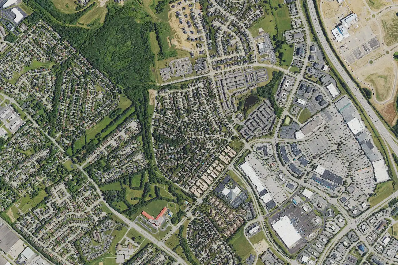
Hamburg, by I-75 in east Lexington, is in ZIP code 40509 and zoned for Douglass High. Its ZIP home value was $402,163 in September 2026.
Last checked Oct. 16, 2026. Sources: OpenStreetMap (the Hamburg neighborhood outline and stores), the Lexington-Fayette Urban County Government’s open data (parks, neighborhood association registry and address points), Fayette County Public Schools’ current attendance boundaries, the Kentucky Department of Education’s 2025-26 accountability data, Lextran’s schedule data and Zillow Research.
Hamburg is the area of east Lexington built up around Hamburg Pavilion, the shopping center at 2308 Sir Barton Way, near I-75 Exits 108 and 110. The city does not map Hamburg as a neighborhood. OpenStreetMap does: its Hamburg outline is a residential area of about 0.12 square mile west of the shopping center, with about 260 residential addresses in the city’s data, all in ZIP code 40509. The facts on this page are for that outline unless they say otherwise.
What this means for you
- Zoned high school: Frederick Douglass High for every address we checked. Check yours in the SchoolSite Locator.
- Home value: $402,163 in ZIP code 40509 in September 2026, according to the Zillow Home Value Index.
- Nearest freeway exit: I-75 Exit 110, Winchester Road (US 60), about 3 miles by road.
Part of our Lexington neighborhoods guide.
Where it is
The outline’s homes are on Rockminster Road, Princess Doreen Drive, Star Gaze Drive, Franks Way, Belmere Drive, Astarita Way, Village Green Avenue, Ogden Way and Ridgefield Lane, according to the city’s address points. Liberty Park is at its edge. Hamburg Pavilion and its stores and restaurants lie to the east, toward I-75; the shopping center’s own site is hamburgpavilion.com.
The city’s registry lists the Hamburg Park Townhomes Owners Association right at the outline’s edge, and the Prestwick and Shetlands homeowners associations nearby. Whether a given home carries association dues is in its deed; the registry does not say.
Schools
Hamburg is in Fayette County Public Schools. We checked all 261 residential addresses in the outline against the district’s current attendance boundaries. Every one was zoned for the same three schools.
| Level | School | 2025-26 state rating |
|---|---|---|
| Elementary | Liberty Elementary, 2585 Liberty Road | High (78.1) |
| Middle | Crawford Middle, 1813 Charleston Drive | Medium (52.1) |
| High | Frederick Douglass High, 2000 Winchester Road | Medium (68.7) |
Ratings are the overall indicator from the Kentucky Department of Education’s 2025-26 accountability data, on a five-step scale from very low to very high; full reports are on the Kentucky School Report Card. Homes elsewhere around the shopping center can fall in other zones, so check any address in the SchoolSite Locator. More in our schools guide.
Home values
The Zillow Home Value Index is a modeled typical value for the middle third of homes, not a sale price. ZIP code 40509 covers much of southeast and east Lexington, including Andover, so it is a broad measure.
| Area | September 2026 | September 2025 | Change |
|---|---|---|---|
| ZIP code 40509 | $402,163 | $392,188 | +2.5% |
| Lexington, for comparison | $331,087 | $320,332 | +3.4% |
Trends are on our home prices page.
Parks and trails
- Liberty Park, 2789 Liberty Road, about 69 acres, at the neighborhood’s edge, from the city’s park data.
- The Hamburg Trail, about 0.3 mile off Sir Barton Way near Winchester Road, is in our walking and biking trails guide.
More in our parks and trails guide.
Getting around
- I-75: Exit 110, Winchester Road (US 60), about 3 miles by road, and Exit 108, Man o’ War Boulevard, about 3.2 miles.
- New Circle Road (KY 4): Exit 13, Winchester Road (US 60), about 3.1 miles, and Exit 15, Richmond Road (US 25 and US 421), about 3.3 miles.
- Downtown (old courthouse on Main Street): about 5.3 miles by road.
- Blue Grass Airport: about 15.5 miles by road.
- Buses: Lextran Route 10 (Hamburg Pavilion) stops beside the neighborhood, and Route 18 (Centre Parkway Connector) about half a mile away, according to Lextran’s schedule data for Oct. 5 to Dec. 19, 2026.
Distances were measured with the OSRM routing engine on OpenStreetMap roads from a point in the middle of the area to the end of each exit ramp. They are distances, not drive times. More in our getting around guide.
Groceries and everyday stores
OpenStreetMap lists these within about a mile:
- Supermarkets: Meijer, 2155 Paul Jones Way; Walmart Supercenter, 2350 Grey Lag Way.
- Pharmacies: Walgreens, 3001 Pink Pigeon Parkway; CVS Pharmacy, 3097 Todds Road; and the pharmacies inside Meijer and Walmart.
Holiday hours for Hamburg Pavilion are in our holiday shopping guide.
Frequently asked questions
What schools is the Hamburg neighborhood in Lexington zoned for?
Every home we checked inside OpenStreetMap’s Hamburg neighborhood outline is zoned for Liberty Elementary, Crawford Middle and Frederick Douglass High in FCPS’s current boundaries.
What ZIP code is Hamburg in Lexington?
- Zillow’s Home Value Index for 40509 was $402,163 in September 2026, up 2.5% from September 2025.
How far is Hamburg from I-75?
About 3 miles by road to I-75 Exit 110, Winchester Road (US 60), and about 3.2 miles to Exit 108, Man o’ War Boulevard, from the middle of the neighborhood.
What park is next to Hamburg?
Liberty Park, a 69-acre city park at 2789 Liberty Road, touches the neighborhood’s edge, according to the city’s park data.
Have your say