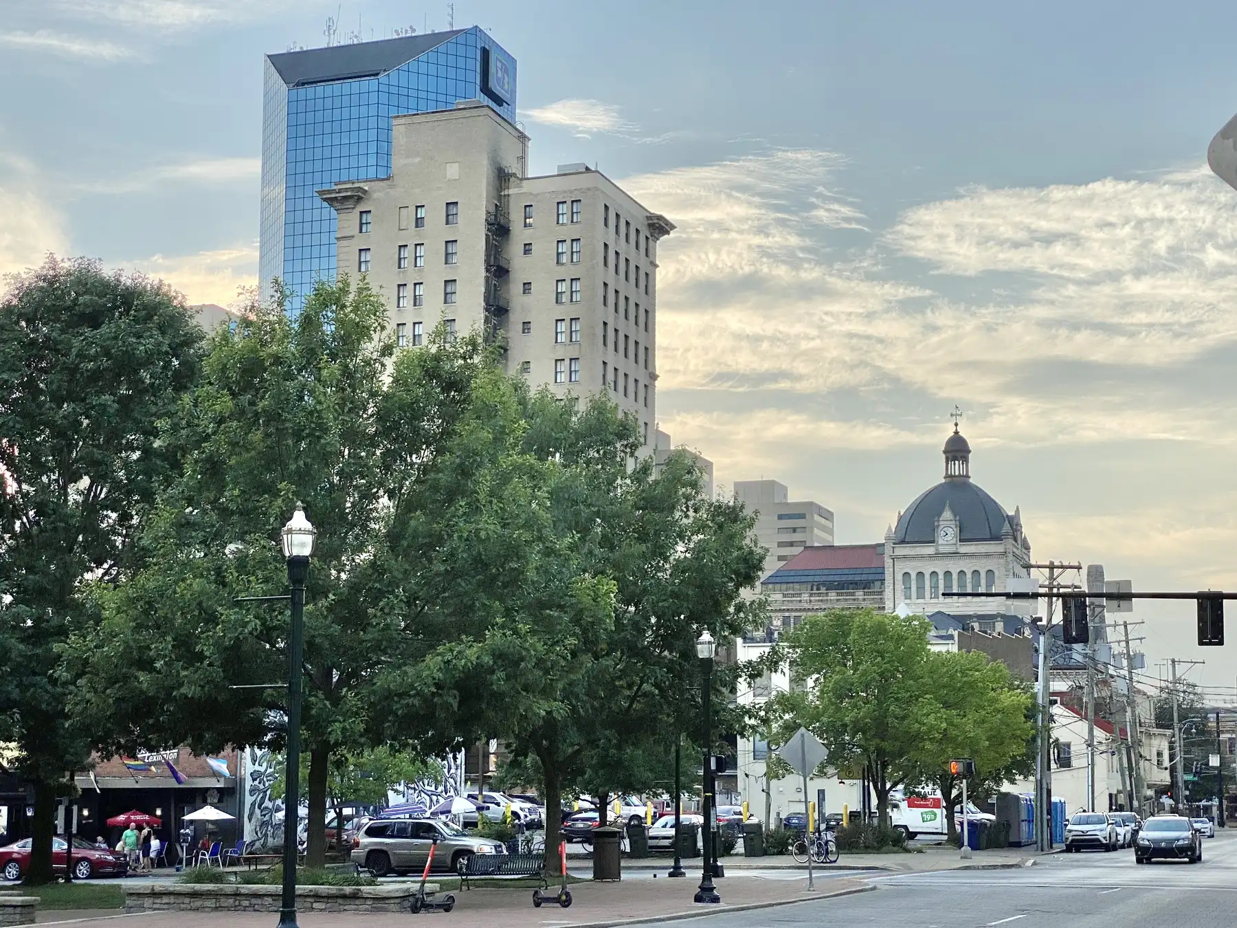
Downtown Lexington is mostly ZIP code 40507, zoned for Lafayette or Henry Clay High. Its ZIP home value was $411,087 in September 2026, per Zillow.
Last checked Oct. 16, 2026. Sources: the Lexington-Fayette Urban County Government’s open data (Central Business District, National Register districts, parks and address points), Fayette County Public Schools’ current attendance boundaries, the Kentucky Department of Education’s 2025-26 accountability data, Lextran’s schedule data, OpenStreetMap and Zillow Research.
Downtown is the center of Lexington and of the urban county. The city’s Central Business District layer covers about 0.24 square mile around Main, Vine, Short and Limestone streets, with about 970 residential addresses in it, mostly apartments and condominiums. Most of it is in ZIP code 40507, with edges in 40508 and 40502.
What this means for you
- Zoned high school: Lafayette High for most addresses, Henry Clay High for the southeast blocks. Check an address in the SchoolSite Locator.
- Home value: $411,087 in ZIP code 40507 in September 2026, according to the Zillow Home Value Index.
- Nearest freeway exit: New Circle Road Exit 9B, Newtown Pike (KY 922), about 2.4 miles by road.
Part of our Lexington neighborhoods guide.
Where it is
The Central Business District takes in the blocks around Main, Vine and Short streets, from the Broadway and Limestone corridors east to Woodland Avenue. Its homes are on streets such as Short Street, Main Street, South Broadway, Rose Street and Woodland Avenue, according to the city’s address points. The old Fayette County Courthouse sits on Main Street at Upper Street. Three districts on the National Register of Historic Places lie inside it, according to the city’s register data: the Victorian Commercial Block (listed 1978), the Downtown Commercial district (1983) and the North Limestone Commercial district (1983).
Downtown property owners inside the Lexington Downtown Management District pay an added assessment of up to 10 cents per $100 of assessed value, re-established by Ordinance 30-2025, according to the Kentucky Department of Revenue’s 2025 Property Tax Rate Book (PDF). The urban county’s own rates are on our property taxes page.
Schools
Downtown is in Fayette County Public Schools. We checked 486 downtown residential addresses from the city’s address points against the district’s current attendance boundaries. All were zoned for Lexington Middle. About 79% were zoned for Harrison Elementary and Lafayette High; the rest, in the southeast blocks, for Ashland Elementary and Henry Clay High.
| Level | School | 2025-26 state rating |
|---|---|---|
| Elementary | Harrison Elementary, 161 Bruce St. | Low (39.8) |
| Elementary | Ashland Elementary, 195 N. Ashland Ave. | Very high (89.1) |
| Middle | Lexington Middle, 350 N. Limestone | Medium (54.8) |
| High | Lafayette High, 401 Reed Lane | Very high (86.9) |
| High | Henry Clay High, 2100 Fontaine Road | High (77.0) |
Ratings are the overall indicator from the Kentucky Department of Education’s 2025-26 accountability data, on a five-step scale from very low to very high; each school’s full report is on the Kentucky School Report Card. Check any address in the SchoolSite Locator. More in our schools guide.
Home values
Zillow publishes no figure for downtown alone. The Zillow Home Value Index is a modeled typical value for the middle third of homes, not a sale price.
| Area | September 2026 | September 2025 | Change |
|---|---|---|---|
| ZIP code 40507 | $411,087 | $376,347 | +9.2% |
| ZIP code 40508 | $225,432 | $220,603 | +2.2% |
| Lexington, for comparison | $331,087 | $320,332 | +3.4% |
Trends are on our home prices page.
Parks and trails
From the city’s park data:
- Henry A. Tandy Centennial Park, 251 W. Main St., the plaza beside the old courthouse.
- Phoenix Park, 100 E. Main St.
- Thoroughbred Park, 121 Midland Ave., about 3.1 acres.
- Triangle Park, 400 W. Main St., privately owned and open to the public.
- Gratz Park, 250 W. Third St., just north of the district.
- Woodland Park, 601 E. High St., about 19 acres, a few blocks southeast.
- The Town Branch Commons trail and park run along Vine Street, according to the city.
More in our parks and trails guide and walking and biking trails guide.
Getting around
- New Circle Road (KY 4): Exit 9B, Newtown Pike (KY 922), about 2.4 miles by road, and Exit 8, Georgetown Road (US 25), about 2.5 miles.
- I-75 and I-64: Exit 113, Paris Pike (US 27 and US 68), about 3.4 miles.
- Blue Grass Airport: about 8.5 miles by road.
- Buses: downtown is the hub of the Lextran system. Routes 1 to 13, 16, 22 and 24, the LexRide Distillery and Warehouse loops (41 and 42) and the night routes 51, 52, 58 and 59 all stop inside the district, according to Lextran’s schedule data for Oct. 5 to Dec. 19, 2026.
Distances were measured with the OSRM routing engine on OpenStreetMap roads from a point in the middle of the area to the end of each exit ramp. They are distances, not drive times. Parking is covered in our getting around guide.
Groceries and everyday stores
OpenStreetMap lists no supermarket inside the district. The nearest:
- Supermarket and pharmacy: Kroger, 704 Euclid Ave., about a mile south.
- Pharmacy: Walgreens, 878 E. High St.
More on what is around the district in our Distillery District guide and history and landmarks guide.
Frequently asked questions
What high school is downtown Lexington zoned for?
Most downtown homes are zoned for Lafayette High, Lexington Middle and Harrison Elementary; the southeast blocks are zoned for Henry Clay High and Ashland Elementary, in FCPS’s current boundaries. Lafayette was rated very high on the 2025-26 Kentucky School Report Card.
What ZIP code is downtown Lexington?
Most of the Central Business District is in ZIP code 40507. Zillow’s Home Value Index for 40507 was $411,087 in September 2026, up 9.2% from September 2025.
Do downtown Lexington property owners pay an extra tax?
Parcels in the Lexington Downtown Management District pay an added assessment of up to 10 cents per $100 of assessed value, under Ordinance 30-2025, according to the Kentucky Department of Revenue’s 2025 rate book.
How far is downtown Lexington from Blue Grass Airport?
About 8.5 miles by road from the middle of downtown, measured on OpenStreetMap roads.
Have your say