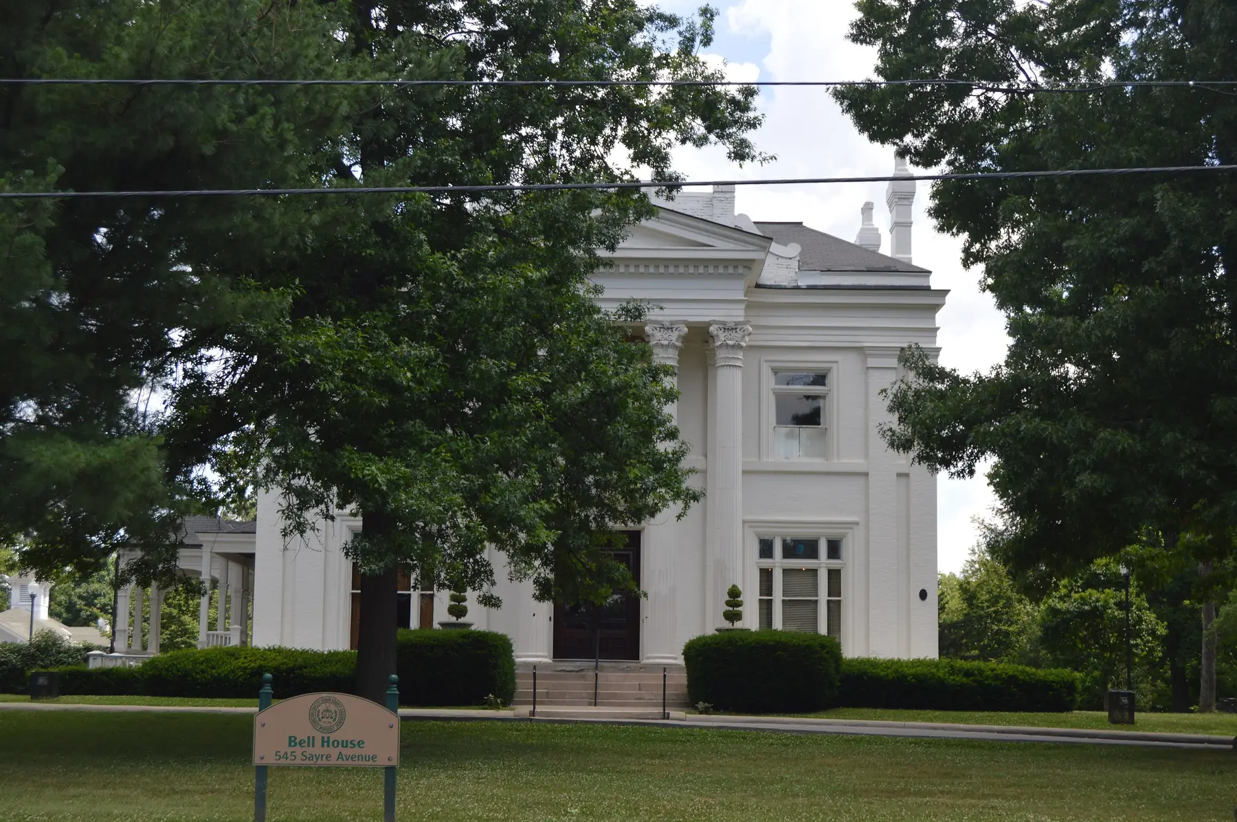
Bell Court is a Lexington historic district in ZIP code 40508, zoned for Henry Clay High. Its ZIP home value was $225,432 in September 2026.
Last checked Oct. 16, 2026. Sources: the Lexington-Fayette Urban County Government’s open data (H-1 overlays, National Register districts, neighborhood association registry, parks and address points), Fayette County Public Schools’ current attendance boundaries, the Kentucky Department of Education’s 2025-26 accountability data, Lextran’s schedule data, OpenStreetMap and Zillow Research.
Bell Court is a small historic neighborhood just east of downtown, built around the park and house called Bell Place. Its local H-1 historic overlay covers about 0.07 square mile with about 240 residential addresses, and the Bell Court Neighborhood was listed on the National Register of Historic Places in 1980, according to the city’s overlay, register and address data. All of it is in ZIP code 40508.
What this means for you
- Zoned high school: Henry Clay High, rated high on the 2025-26 state report card. Check an address in the SchoolSite Locator.
- Home value: $225,432 in ZIP code 40508 in September 2026, according to the Zillow Home Value Index.
- Nearest freeway exit: New Circle Road Exit 13, Winchester Road (US 60), about 2.3 miles by road.
Part of our Lexington neighborhoods guide.
Where it is
The overlay takes in East and West Bell Court, Bell Place, Sayre, Boonesboro, Delmar and Russell avenues, Forest Avenue and a stretch of East Main Street, according to the city’s address points. OpenStreetMap places Bell Court between the Aylesford and Woodland Triangle neighborhoods to the west and the East End to the north.
In an H-1 overlay, most exterior changes, new buildings and demolitions need a certificate of appropriateness before work starts, under the urban county’s historic preservation zoning rules. Homes here include apartments: about 95 of the overlay’s addresses carry a unit number. The Bell Court Neighborhood Association is on the city’s neighborhood association registry.
Schools
Bell Court is in Fayette County Public Schools. We checked all 242 residential addresses in the overlay against the district’s current attendance boundaries. Every one was zoned for the same three schools.
| Level | School | 2025-26 state rating |
|---|---|---|
| Elementary | Ashland Elementary, 195 N. Ashland Ave. | Very high (89.1) |
| Middle | Lexington Middle, 350 N. Limestone | Medium (54.8) |
| High | Henry Clay High, 2100 Fontaine Road | High (77.0) |
Ratings are the overall indicator from the Kentucky Department of Education’s 2025-26 accountability data, on a five-step scale from very low to very high; full reports are on the Kentucky School Report Card. Zones can change, so check an address in the SchoolSite Locator before you sign. More in our schools guide.
Home values
The Zillow Home Value Index is a modeled typical value for the middle third of homes, not a sale price. ZIP code 40508 also takes in the East End and much of the Northside, so it is a broad measure.
| Area | September 2026 | September 2025 | Change |
|---|---|---|---|
| ZIP code 40508 | $225,432 | $220,603 | +2.2% |
| Lexington, for comparison | $331,087 | $320,332 | +3.4% |
Trends are on our home prices page.
Parks and trails
From the city’s park data:
- Bell Place, 545 Sayre Ave., about 4.7 acres, in the middle of the neighborhood.
- Charles Young Park, 215 Midland Ave., about 3.6 acres, just north.
- Thoroughbred Park, 121 Midland Ave., toward downtown.
- Woodland Park, 601 E. High St., about 19 acres, a few blocks south.
More in our parks and trails guide.
Getting around
- New Circle Road (KY 4): Exit 13, Winchester Road (US 60), about 2.3 miles by road, and Exit 15, Richmond Road (US 25 and US 421), about 2.8 miles.
- I-75 and I-64: Exit 113, Paris Pike (US 27 and US 68), about 4.1 miles.
- Downtown (old courthouse on Main Street): about 0.9 mile by road.
- Blue Grass Airport: about 9.2 miles by road.
- Buses: Lextran Routes 10 (Hamburg Pavilion) and 11 (Richmond Road), the LexRide Warehouse Loop (42) and night route 51 stop in the neighborhood, according to Lextran’s schedule data for Oct. 5 to Dec. 19, 2026.
Distances were measured with the OSRM routing engine on OpenStreetMap roads from a point in the middle of the area to the end of each exit ramp. They are distances, not drive times. More in our getting around guide.
Groceries and everyday stores
OpenStreetMap lists these within about 1.5 miles:
- Supermarket and pharmacy: Kroger, 704 Euclid Ave.
- Pharmacies: Walgreens, 878 E. High St.; Wheeler’s, 336 Romany Road.
The neighborhood’s history is in our history and landmarks guide.
Frequently asked questions
What schools is Bell Court in Lexington zoned for?
Every home we checked in the Bell Court historic overlay is zoned for Ashland Elementary, Lexington Middle and Henry Clay High in FCPS’s current boundaries. Ashland was rated very high and Henry Clay high on the 2025-26 Kentucky School Report Card.
Is Bell Court a historic district?
Yes. The Bell Court Neighborhood was listed on the National Register of Historic Places in 1980, and it is a local H-1 historic overlay, where most exterior changes need a certificate of appropriateness.
What ZIP code is Bell Court in?
- Zillow’s Home Value Index for 40508 was $225,432 in September 2026, up 2.2% from September 2025; Zillow publishes no figure for Bell Court alone.
What park is in Bell Court?
Bell Place, a city park of about 4.7 acres at 545 Sayre Ave., is in the middle of the neighborhood. Woodland Park, about 19 acres, is a short walk south at 601 E. High St.
Have your say