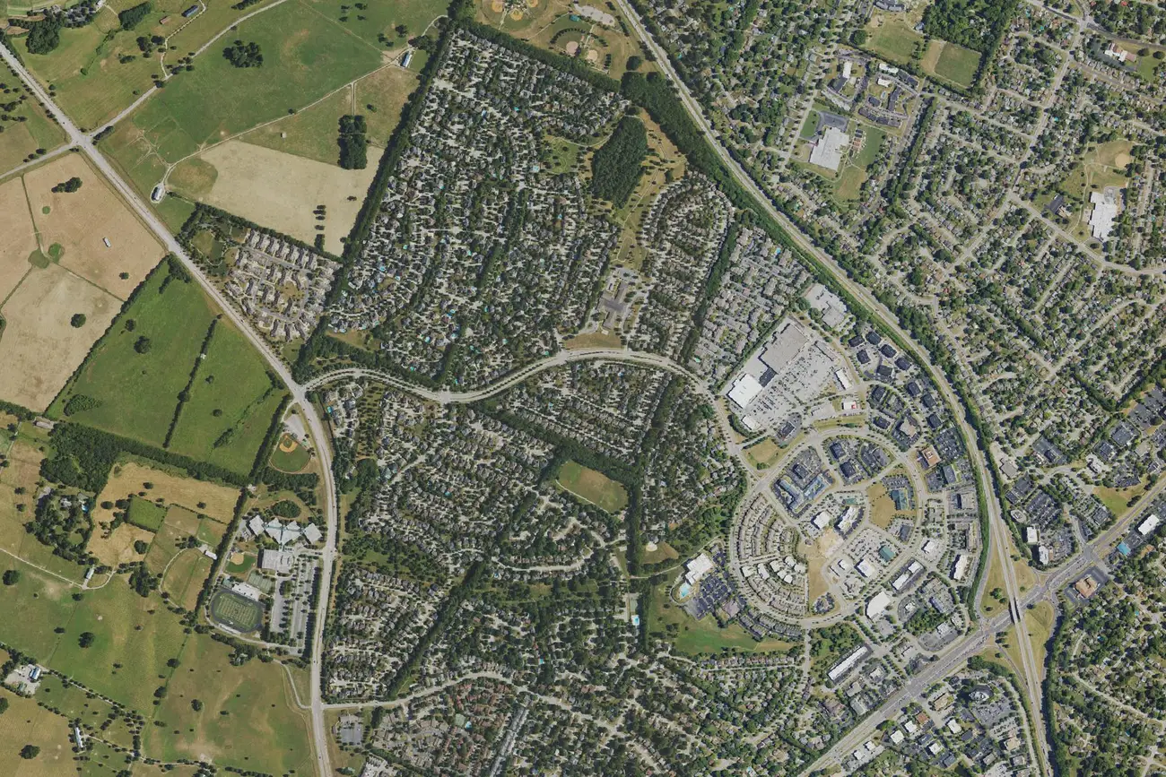
Beaumont, in southwest Lexington, is in ZIP code 40513 and zoned for Dunbar High. Its ZIP home value was $569,824 in September 2026, per Zillow.
Last checked Oct. 16, 2026. Sources: the Lexington-Fayette Urban County Government’s neighborhood association registry and open data (parks and address points), Fayette County Public Schools’ current attendance boundaries, the Kentucky Department of Education’s 2025-26 accountability data, Lextran’s schedule data, OpenStreetMap and Zillow Research.
Beaumont is a neighborhood in southwest Lexington, outside New Circle Road, around Beaumont Centre. We used the boundary of the Beaumont Residential Association as the city’s registry maps it: about 1.1 square miles with about 1,850 residential addresses, all in ZIP code 40513.
What this means for you
- Zoned high school: Paul Laurence Dunbar High for every address we checked, rated high for 2025-26. Check yours in the SchoolSite Locator.
- Home value: $569,824 in ZIP code 40513 in September 2026, according to the Zillow Home Value Index.
- Nearest freeway exit: New Circle Road Exit 5A, Versailles Road (US 60), about 4.3 miles by road.
Part of our Lexington neighborhoods guide.
Where it is
The association’s area has homes on Beaumont Centre Lane, Pine Needles Lane, Allegheny Way, Malone Drive and many shorter lanes, according to the city’s address points.Rosa Parks Elementary, at 1251 Beaumont Centre Lane, is inside the area. OpenStreetMap places Beaumont Park just north of it.
HOAs
Besides the Beaumont Residential Association, the city’s registry lists three smaller associations inside its area: Heritage Place Condominium Association, Glenview Townhomes HOA and the 3151 Beaumont Council of Co-owners. Whether a given home carries association dues is in its deed; the registry does not say.
Schools
Beaumont is in Fayette County Public Schools. We checked 464 residential addresses in the area against the district’s current attendance boundaries. Every one was zoned for the same three schools.
| Level | School | 2025-26 state rating |
|---|---|---|
| Elementary | Rosa Parks Elementary, 1251 Beaumont Centre Lane | Very high (92.5) |
| Middle | Beaumont Middle, 2080 Georgian Way | High (71.7) |
| High | Paul Laurence Dunbar High, 1600 Man o’ War Blvd. | High (74.5) |
Ratings are the overall indicator from the Kentucky Department of Education’s 2025-26 accountability data, on a five-step scale from very low to very high; full reports are on the Kentucky School Report Card. Check any address in the SchoolSite Locator. More in our schools guide.
Home values
The Zillow Home Value Index is a modeled typical value for the middle third of homes, not a sale price. ZIP code 40513 covers a wider area of southwest Lexington than the association’s map.
| Area | September 2026 | September 2025 | Change |
|---|---|---|---|
| ZIP code 40513 | $569,824 | $538,933 | +5.7% |
| Lexington, for comparison | $331,087 | $320,332 | +3.4% |
Trends are on our home prices page.
Parks and trails
From the city’s park data:
- Beaumont Preserve, 2020 Allegheny Way, about 23 acres.
- Harrods Hill Park, 3308 Ridgecane Road, about 13 acres.
- Moondance Amphitheater, 1152 Monarch St.
- Cardinal Run Park South, 2000 Parkers Mill Road, about 55 acres, a regional park at the west edge; Cardinal Run Park North, 2075 Parkers Mill Road, about 138 acres, is nearby on the same road.
- Beaumont Park, 2034 Williamsburg Drive, a natural area of about 9 acres, just north.
More in our parks and trails guide.
Getting around
- New Circle Road (KY 4): Exit 5A, Versailles Road (US 60), about 4.3 miles by road, and Exit 5B, about 4.6 miles.
- I-75 and I-64: Exit 113, Paris Pike (US 27 and US 68), about 8.4 miles.
- Downtown (old courthouse on Main Street): about 5.7 miles by road.
- Blue Grass Airport: about 4.5 miles by road.
- Buses: Lextran Route 13 (South Broadway) and night route 58 stop in the area, and Route 8 (Versailles Road) stops about half a mile away, according to Lextran’s schedule data for Oct. 5 to Dec. 19, 2026.
Distances were measured with the OSRM routing engine on OpenStreetMap roads from a point in the middle of the area to the end of each exit ramp. They are distances, not drive times. More in our getting around guide.
Groceries and everyday stores
OpenStreetMap lists these inside or near the area:
- Supermarkets: Kroger, 3175 Beaumont Centre Circle, inside the area; Walmart Neighborhood Market, 3735 Palomar Centre Drive; Kroger, 1080 Alexandria Drive.
- Pharmacy: Kroger Pharmacy, about 1.3 miles from the middle of the area.
Frequently asked questions
What schools is Beaumont in Lexington zoned for?
Every home we checked in the Beaumont Residential Association’s area is zoned for Rosa Parks Elementary, Beaumont Middle and Paul Laurence Dunbar High in FCPS’s current boundaries. Rosa Parks was rated very high and Beaumont Middle and Dunbar high for 2025-26.
What ZIP code is Beaumont in Lexington?
- Zillow’s Home Value Index for 40513 was $569,824 in September 2026, up 5.7% from September 2025.
What parks are in Beaumont?
Beaumont Preserve, Harrods Hill Park, Moondance Amphitheater and the south section of Cardinal Run Park are in or touching the area, according to the city’s park data.
How far is Beaumont from Blue Grass Airport?
About 4.5 miles by road from the middle of the neighborhood, measured on OpenStreetMap roads.
Have your say